
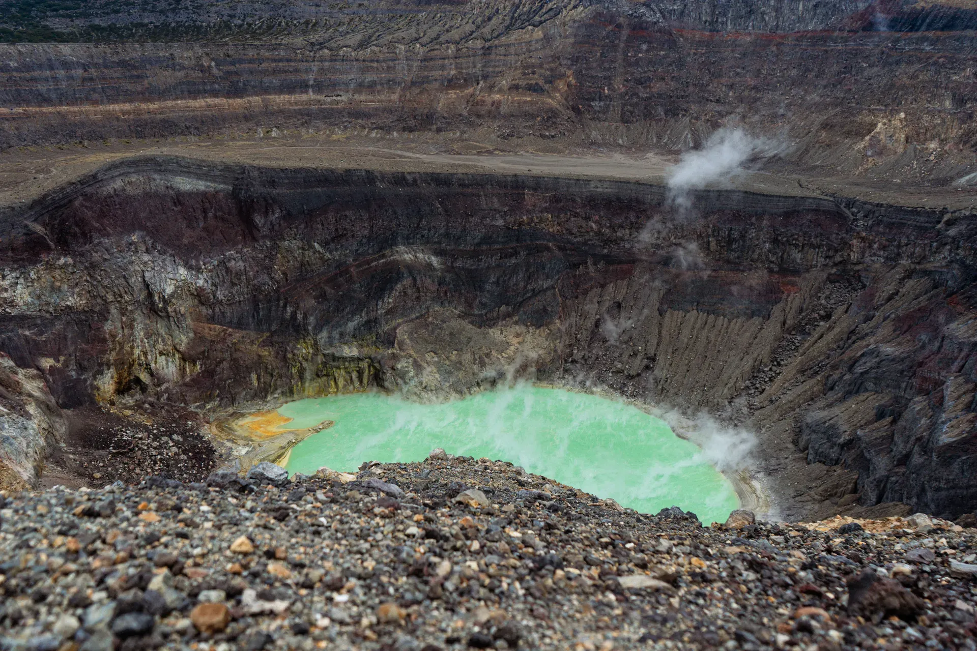
Rising 2,697 meters above sea level in Costa Rica's Alajuela Province, Poás Volcano contains one of the world's most acidic crater lakes. NASA researchers study this active stratovolcano to understand ancient hydrothermal systems on Mars.
Poás Volcano dominates the Cordillera Central range, rising 2,697 meters above sea level just 50 kilometers north of San José. The active stratovolcano spans 100 cubic kilometers of rock and ash. Two distinct crater lakes sit at the summit, offering a stark contrast in geothermal activity. Laguna Caliente occupies the active main crater, bubbling with toxic fumaroles and maintaining a pH of less than one. Botos Lagoon fills an extinct crater nearby, holding cold, clear rainwater surrounded by dense cloud forest.
Sulfur dioxide and hydrogen sulfide gases frequently sweep across the viewing platform. The smell of rotten eggs hits visitors as they walk the 600-meter paved trail from the modern visitor center. NASA scientists regularly visit this hostile environment. They use the extreme acidity and high temperatures—sometimes reaching 85°C—to model hydrothermal systems that may have existed on ancient Mars. The site holds international recognition as one of the first 100 IUGS Geological Heritage Sites due to its complex tectonic history.
The park ranks among the most accessible natural attractions in Central America. The main path to the crater overlook is fully paved, flat, and gently graded, allowing manual wheelchairs and power chairs to navigate independently. The visitor center features accessible restrooms, designated disabled parking spaces, and interactive educational exhibits detailing the volcano's geological history. Upstairs, a spacious cafeteria serves hot specialty coffees, fresh empanadas, and sweet pastries to visitors escaping the cold mountain air.
Thick fog often completely obscures the crater after 10:30 AM. Heavy rainfall during the May to November wet season turns the unpaved Botos Trail into a muddy slip hazard. Visitors must book specific 20-minute entry slots online before arriving, as the park sells no tickets at the gate. Foreign adults pay $15 USD, plus a 2,000 colones parking fee. The typical visit lasts between 1.5 to 2.5 hours, allowing enough time to walk both trails and view the exhibits.
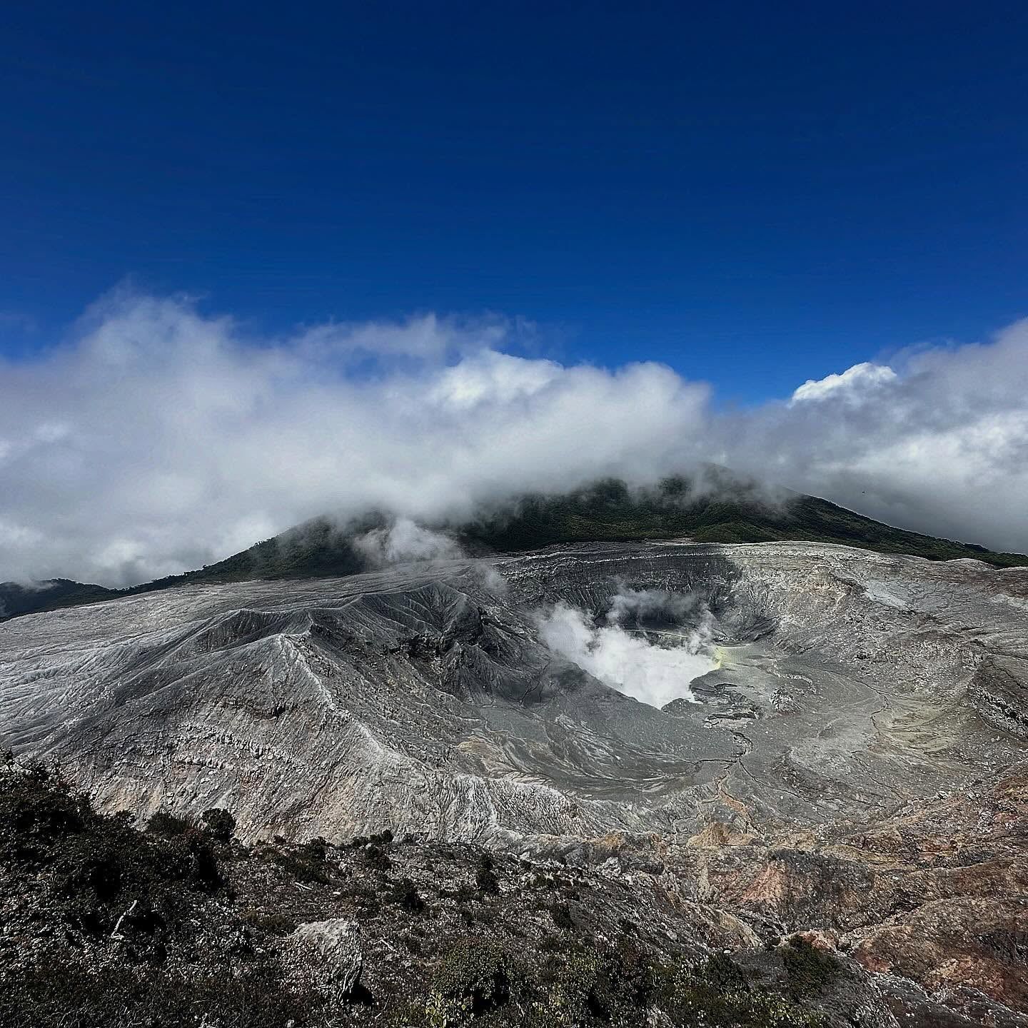
Caldera formation initiated the geological life of Poás between 10,000 and 20,000 years ago. Composite cone construction followed, gradually building the massive 100-cubic-kilometer structure visible today. Flank subsidence and multiple crater collapses shaped the summit over millennia, creating the distinct depressions that now hold Laguna Caliente and Botos Lagoon. The volcano belongs to the Central America Volcanic Arc, driven by the continuous subduction of the Cocos tectonic plate beneath the Caribbean plate. This tectonic friction fuels the geothermal activity that keeps the main crater boiling.
Spanish colonists first documented an eruption in 1747. Since that initial record, scientists have logged at least 54 distinct eruptive events, averaging one major disturbance every 5.2 years. Phreatic eruptions dominate the volcano's historical pattern. These violent, steam-driven explosions occur when cold groundwater flashes to steam upon contacting shallow magma. The resulting pressure ejects ash, mud, and boiling acidic water hundreds of meters into the air, frequently reshaping the crater floor and altering the depth of Laguna Caliente.
A massive eruption in April 2017 shattered the main viewing platform and forced authorities to evacuate the entire mountain. The national park remained completely closed for 16 months. During this extended shutdown, the Costa Rican government overhauled the site's infrastructure to protect future tourists. Crews installed real-time gas sensors and constructed five reinforced concrete safety shelters near the crater rim. Park rangers now strictly enforce a 20-minute time limit at the overlook to minimize visitor exposure to toxic sulfur dioxide and hydrogen sulfide gases.
Eruptive cycles resumed with significant activity in 2019 and continued through 2024. A new eruptive phase began in February 2026, prompting heightened monitoring by local volcanologists. Visitors today must wear hard hats provided at the reception area before walking the 600-meter path to the crater. Anyone caught entering restricted off-trail zones like the sulfuric "Canyon of Mordor" faces immediate detention by park rangers and formal referral to the Public Prosecutor's office. The park maintains strict evacuation protocols, requiring visitors to exit through the main gate and drive downhill if gas sensors trigger an alarm.
Tourism at Poás developed steadily throughout the 20th century as roads improved between San José and the Alajuela Province. Early visitors hiked rugged dirt paths to reach the summit, often camping near the crater rim before modern safety regulations existed. The establishment of the national park formalized conservation efforts and restricted overnight stays. Today, the site operates under a highly controlled reservation system managed by SINAC, requiring visitors to provide full names and passport numbers to secure a 20-minute entry window.
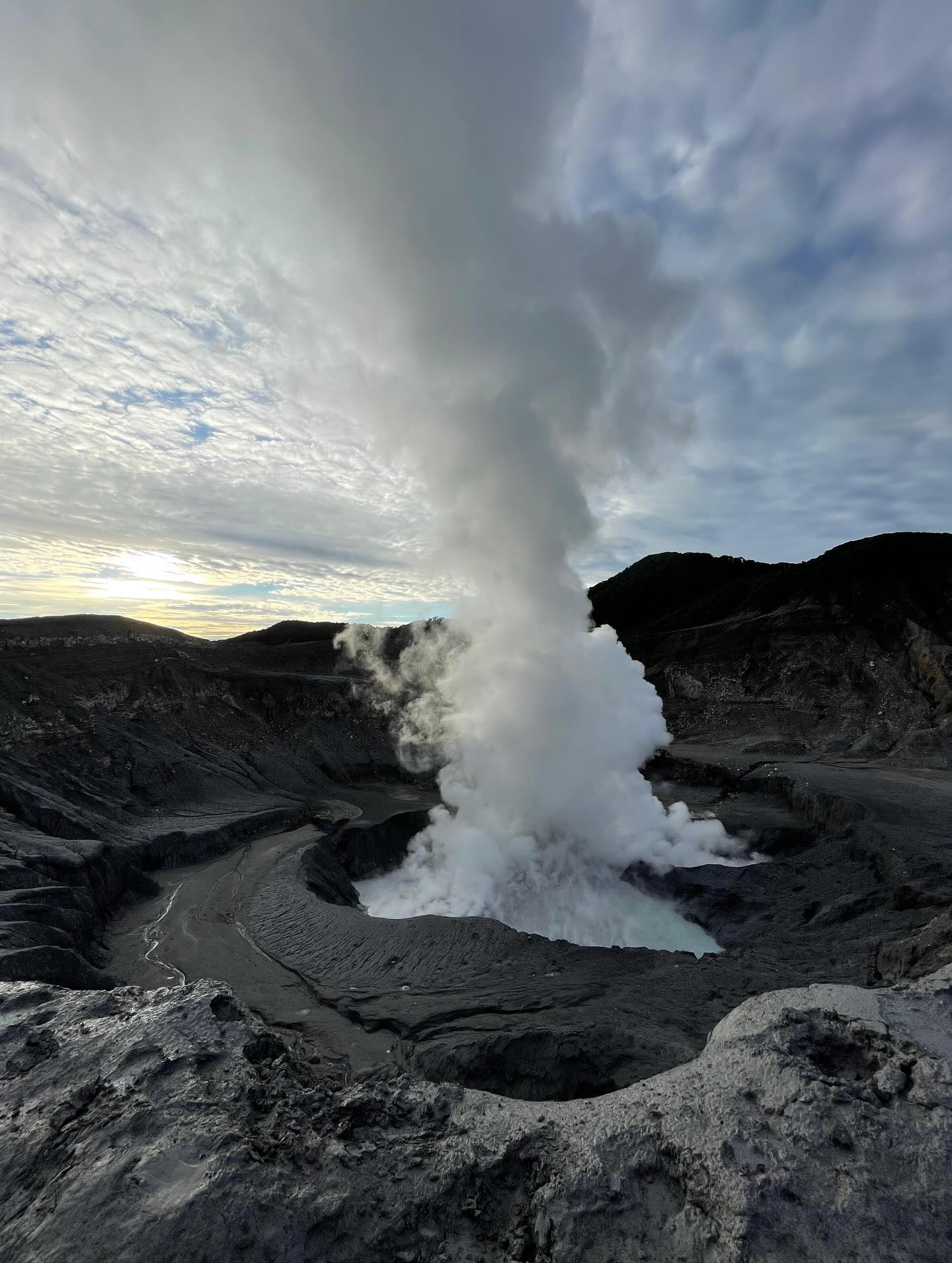
A 1.5-kilometer-wide crater dominates the summit, dropping 300 meters down to the active lake. Laguna Caliente measures roughly 300 meters across, though its exact size fluctuates based on rainfall and evaporation rates. The water glows a striking turquoise color due to suspended sulfur particles and dissolved minerals. Active fumaroles line the crater walls and lake bottom, venting steam and gases at temperatures reaching 85°C. The water maintains a pH of less than one, making it millions of times more acidic than tap water. This extreme acidity actively dissolves the surrounding volcanic rock, adding heavy metals to the chemical soup.
Dense cloud forest surrounds the volcanic peak, thriving in the cool, high-altitude environment of 9,000 feet. Mosses, bromeliads, and epiphytes cling to the twisted branches of the trees along the Botos Lagoon trail. This 40-minute hiking path leads hikers through a canopy filled with tropical bird calls before culminating at an extinct crater. Botos Lagoon spans 400 meters in diameter and sits at an elevation of 2,582 meters. The dark, tranquil water consists entirely of cold rainwater. This peaceful setting contrasts sharply with the violent, boiling activity of the main crater just a kilometer away.
The surrounding landscape features steep, winding mountain roads that cut through agricultural towns like Fraijanes and Poasito. Volcanic soil provides ideal conditions for the local strawberry farms and coffee plantations lining Route 712. Roadside stands sell fresh-picked volcanic strawberries, local cheeses, and hot chocolate to drivers making the ascent. The drive requires navigating narrow switchbacks, and drivers burn significantly more fuel here than on standard highways. Gas stations do not exist near the park entrance, so vehicles must fuel up in Alajuela before making the 50-kilometer climb.
Beyond the immediate crater zone, the volcanic slopes feed into broader ecological corridors. La Paz Waterfall Gardens sits just 30 minutes north of the volcano, featuring a 37-meter-high waterfall fed by mountain runoff. Braulio Carrillo National Park lies an hour away, protecting a vast expanse of primary tropical rainforest on the Caribbean slope. The high altitude of the entire region causes rapid temperature changes, requiring visitors to pack high-quality rain jackets and microfiber cloths to wipe away constant lens fogging.
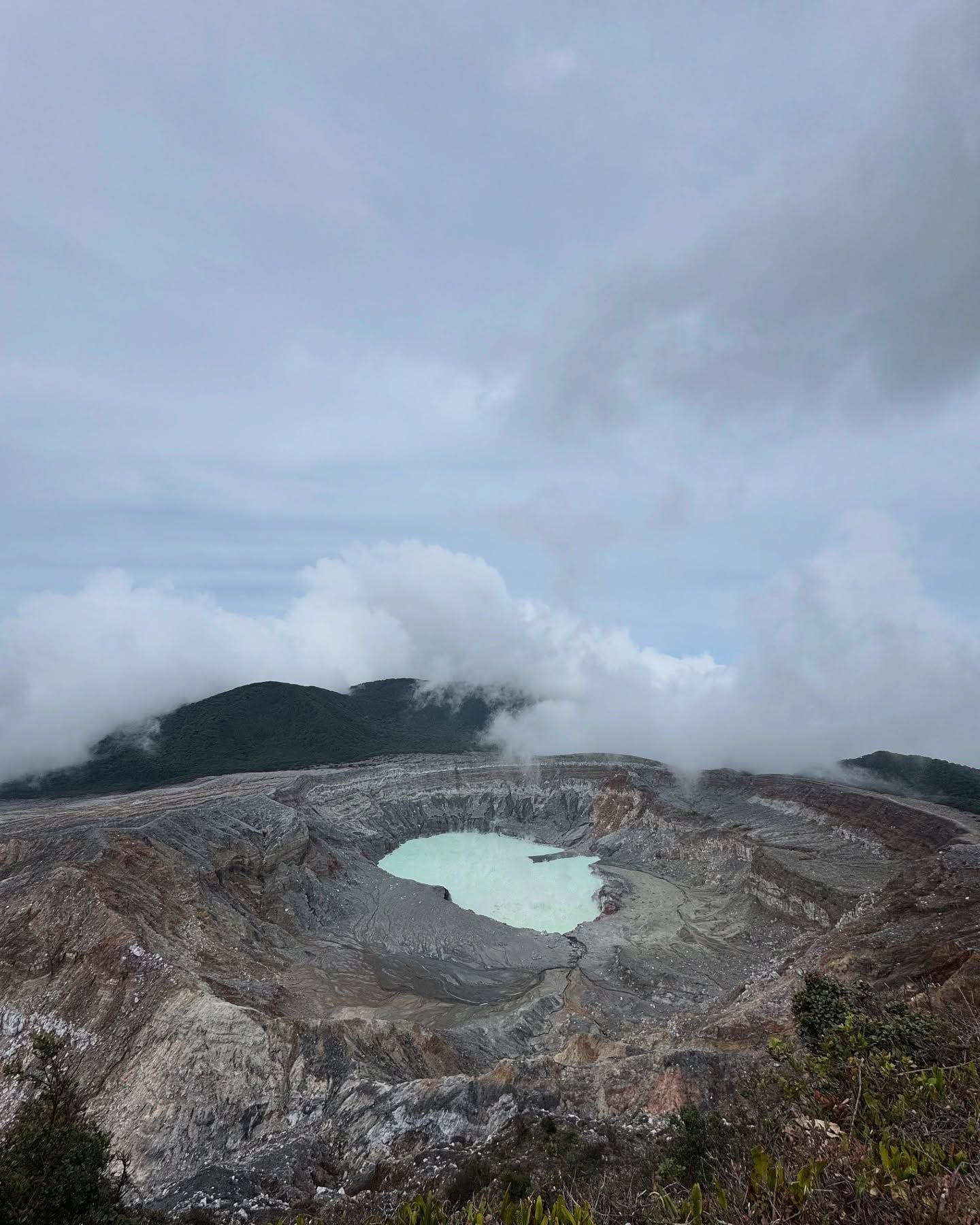
Poás Volcano dictates the agricultural rhythm of the Alajuela Province. The constant deposit of volcanic ash over millennia has created highly fertile Andisol soils across the Central Valley. Farmers in Fraijanes and Poasito rely on this mineral-dense dirt to cultivate strawberries, dairy cattle, and high-altitude coffee. Hacienda Alsacia, the only commercial coffee farm owned by Starbucks, operates just 30 minutes from the crater, directly benefiting from the mountain's unique microclimate. Doka Estate, another historic coffee plantation located 45 minutes away, also utilizes the volcanic soil to produce traditional Costa Rican roasts.
The volcano anchors Costa Rica's scientific community. Local volcanologists and international researchers use the site as a primary field laboratory to study tectonic movements and geothermal chemistry. NASA's ongoing studies of Laguna Caliente have elevated the volcano's status from a regional landmark to a site of global astrobiological interest. The extreme conditions provide tangible data for understanding how microbial life might survive in harsh, acidic environments across the solar system, specifically drawing parallels to ancient hydrothermal systems on Mars.
Unauthorized exploration of the volcano's restricted zones has created a subculture of extreme hiking. Areas like the "Canyon of Mordor" (Quemaderos del Poás) attract trespassers seeking close encounters with sulfuric vents. Park authorities actively combat this trend to prevent severe injuries and protect the fragile geothermal landscape. Repeat offenders face formal prosecution, and rangers maintain daily patrols to secure the perimeter. The local government strictly regulates access, requiring visitors to provide full names and passport numbers during the mandatory online booking process.
The mountain also shapes local transportation and daily commutes. The TUASA bus runs from Iglesia Parque de la Merced in San José to Alajuela, connecting urban workers with the agricultural highlands. From Prospero Fernandez Park, the COOPETRANSI bus carries weekend visitors directly to the national park for 4,000 colones round trip. This infrastructure binds the rural farming communities to the capital, ensuring the continuous flow of volcanic crops to city markets.
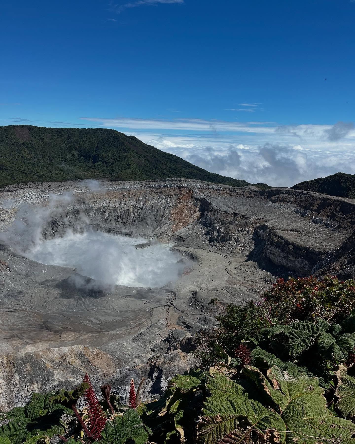
Laguna Caliente has a pH of less than 1, making it one of the most acidic lakes on Earth.
NASA studies the crater lake to model ancient hydrothermal systems that may have existed on Mars.
Visitors must wear hard hats at the viewing platform to protect against sudden phreatic eruptions.
Park rangers strictly enforce a 20-minute time limit at the crater overlook to minimize toxic gas exposure.
The volcanic soil surrounding Poás supports massive strawberry farms in the nearby towns of Fraijanes and Poasito.
Flying drones over the volcano is strictly prohibited under a Temporary Flight Restriction zone.
The only commercial coffee farm owned by Starbucks, Hacienda Alsacia, sits just 30 minutes from the volcano.
Yes, you must purchase tickets on the official SINAC website before arriving. The park does not sell tickets at the entrance gate. You will need to select a specific date and 20-minute entry slot, and provide passport numbers for all visitors.
Foreign adults pay $15 USD and children aged 2 to 12 pay $5 USD, plus applicable taxes. Costa Rican citizens and residents pay 1,000 colones for adults and 500 colones for children. Parking costs an additional 2,000 colones per car.
A 4x4 vehicle is not required. The 50-kilometer route from San José is fully paved all the way to the park entrance. Drivers should proceed slowly, as the mountain roads are steep, narrow, and winding.
The park opens daily from 8:00 AM to 4:00 PM, including all national holidays. The final entry permitted into the park is at 2:00 PM. Arriving for the 8:00 AM slot offers the highest chance of clear crater visibility.
The main 600-meter path to the crater overlook is fully paved, flat, and gently graded. Manual wheelchairs with a companion or power wheelchairs can navigate the route easily. The visitor center also provides accessible restrooms and designated parking.
Water temperatures in Laguna Caliente fluctuate based on volcanic activity. Measurements have recorded temperatures as high as 85°C (185°F). The water is also highly acidic, with a pH of less than one.
Sudden phreatic eruptions can eject steam, ash, and boiling water without warning. The park provides hard hats to all visitors before they walk to the crater to mitigate the risk of injury from falling debris.
Flying drones or any other aircraft is strictly prohibited. The national park operates under a Temporary Flight Restriction zone. Park rangers enforce this rule to protect the environment and ensure visitor safety.
The park maintains real-time gas sensors and five reinforced concrete safety shelters at the viewpoint. If rangers issue an alert, visitors must immediately follow their instructions, exit through the main gate, and drive downhill.
Pack a high-quality rain jacket and dress in warm layers. The summit sits at 9,000 feet, where temperatures remain cool and sudden rain showers occur frequently. Closed-toe shoes provide necessary traction for the unpaved Botos Trail.
Browse verified tours with free cancellation and instant confirmation.
Find Tours